SAN FRANCISCO URBAN AGRICULTURE
LA C188: GEOGRAPHIC INFORMATION SYSTEMS 2013
CONTRIBUTORS: Jaclyn Berry, George Lee, Christine Liao
Food scarcity and unequal access to nutritious food is a growing challenge in urban communities, particularly for low income residents. In an effort to ameliorate this problem, residents all over the Bay Area have established local community gardens and high-yield urban farms that not only provide an affordable source of healthy food for people in need, but also provide educational resources, build community, and empower their residents to take charge of their own food production.
Community farms must be situated to balance optimal growing conditions and accessibility for communities in need. This project explores how demographic and geographic data can be used to identify viable sites for new urban farms and community gardens in San Francisco. More broadly, this project explores how data can be used as a supplemental tool to inform design decisions for architectural, environmental, and user-centered design problems.
My contribution to this project included acquiring data, generating data visualizations, defining the weighting system for the final data analysis, and designing the graphic presentation.
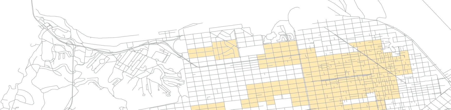
Population & Transit
We needed to identify where residents would be optimally served by new community gardens. We considered income, population density, proximity to public transit, and bike accessibility. We made the assumption that low income earners were less likely to own a car and would therefore rely on other means of transport for their daily needs. Additionally, due to the rising cost of living in San Francisco, we considered low income to be annual household earnings under $70,000. The regions highlighted in the diagrams below were all weighted positively in the final suitability analysis.
Geography & Environment
Next we identified locations that would support vegetation and crop cultivation. Plants need clean soil, sun, and water to flourish. South facing land with high solar radiation was weighted positively and land with contaminated soils or steep slopes was weighted negatively.
Service Area
Our last data layers identified areas serviced by existing grocery stores and community gardens. The stores and gardens were represented by point data and the service area was represented by polygons. Areas that were already near existing grocery stores and gardens (the dark red polygons) were weighted negatively in our analysis.
For the final suitability analysis, we combined all 10 layers of data weighted by importance to identify the best locations for new community gardens in San Francisco. The following flowchart describes our process.
THE RESULTS
The final analysis showed vacant lots in the following areas would benefit food accessibility for low income residents:
| • Sea Cliff | • Fillmore District |
| • Lake Street | • Inner Mission |
| • Inner Richmond | • Bay View |
| • Central Richmond | • Hunter's Point |
| • Lakeshore | • Portola |
| • Stonestown |
A REVIEW IN RETROSPECT
After revisiting this project, I realized that modifying our data layers and refining our weighting system could improve our analysis. The existing layer for household income could be changed to normalize income based on household size and the layer locating grocery stores could differentiate between convenience stores and markets carrying nutritious food. Additional layers that could strengthen the analysis might include a shadow layer showing where urban development blocks solar radiation, water infrastructure, and land value, to name a few. We could also create a more rigorous weighting system by visiting existing community gardens and interviewing participants to identify what really makes the garden a success.